Know which cutblocks need an inspector before you drive out.
Field audits check the blocks you can reach. Harvest Compliance compares the actual cut boundary with each permit and riparian buffer every quarter, and hands you a list of overcut and buffer incursions to review first.
Field audit only
With Harvest Compliance
- GSD
- High / 0.5–2 m
- Cadence
- Quarterly
- Platform
- High-res satellite
- Spectral
- RGB + NIR
The job today
Who gets visited this quarter
There are more permits than inspector days. So the visit list comes from a sample, a complaint, or the blocks nobody has looked at in a while. The inspector drives out, walks the cut line against the harvest plan and looks along the stream for cutting inside the buffer. An overcut on a block that never made the list sits there until the next cycle.
The same arithmetic catches a certifier choosing which of a client's blocks to sample before a surveillance audit.
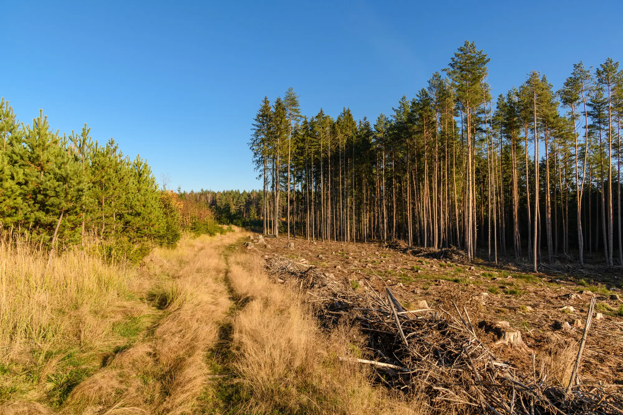
Comparison
The same review, done two ways
01Choosing which blocks to visit
Field audit onlyA sample, the complaints that came in, and the blocks due by rotation.
With Harvest ComplianceThe quarter's flag list, sorted so blocks with overcut or buffer incursions are at the top. Blocks with no flags go to the bottom of the list.
02Checking the cut line against the permit
Field audit onlyAn inspector walks the boundary with the harvest plan.
With Harvest ComplianceEach cut boundary is laid over the permit boundary, and cleared ground outside the line is flagged as overcut with its area.
Still yoursDeciding whether a flagged sliver is a real overcut, a survey offset or an approved amendment.
03Looking at the riparian buffer
Field audit onlyWalking the stream edge to see whether cutting crossed the setback.
With Harvest ComplianceCleared ground inside the buffer you supplied is flagged as an incursion, block by block.
04Blocks between visits
Field audit onlyA block is only known as well as its last site visit.
With Harvest ComplianceA new comparison each quarter, so a block that was clean last time and overcut since shows up on the next list.
05Writing it up and referring it
Field audit onlyThe inspector's site report, then the referral to enforcement or the client's corrective action process.
With Harvest ComplianceAn exportable audit list to attach to the file and to hand the field team.
Still yoursThe site visit, the finding and the referral. A flag is a reason to look. It is never a finding.
What you get
What lands each quarter
One set of files per quarterly pass, in formats your GIS and inspection system already open.
- GeoPackage
Overcut flags
Cleared ground outside the permit boundary, one feature per item with its block and area. Opens in the GIS your review team already uses.
Serves the cut-line row - GeoPackage
Buffer incursion flags
Cleared ground inside the riparian buffer you gave us, one feature per item.
Serves the buffer row - GeoPackage
Cut-boundary overlay
The actual cut drawn over the permit boundary and buffer, for each block, so the reviewer sees the mismatch before deciding whether to send anyone.
- CSV
Audit list
One row per flag: block or permit number, flag type, area, the quarter. Opens in a spreadsheet.
Serves the referral row
How it works
Through the review quarter
You load the permits once. The comparison comes back each quarter in time for the compliance review.
Before the first quarter
Load the permits and buffers
Send the permit boundaries and the riparian buffers, with the setback each one is held to.
Set the review quarter
Tell us the quarter dates your review runs to, so passes line up with your inspection scheduling.
Each quarter
Pass over the blocks
A high-resolution satellite pass is acquired over the permitted blocks, from the first usable clear-sky image in the quarter.
Compare cut to permit
The cut boundary read from the imagery is compared with the permit boundary and buffer. Overcut and incursions are flagged.
Flags go out
The GeoPackage layers, the overlay and the CSV audit list, ahead of the compliance review.
Limits
What the field audit still does better
Read these before you plan an inspection list around the flags.
Narrow incursions can slip through
The imagery is 0.5–2 m per pixel. A strip of cutting has to be several pixels across to show. At the coarse end of that range a narrow gap or a few removed trees in the buffer will not register clearly. An inspector on foot sees them.
Cloud and light set the pass
The imagery is optical. If a block is under cloud for the whole quarter, it gets no comparison until the next usable pass, and the list says so. Nothing is filled in with a guess.
What happened under standing trees
A comparison of cleared ground cannot see selective removal under a canopy that is still there, or what a cutter did with slash, roads or landings. That is walking work.
A flag is not a finding
Nothing on the list says a rule was broken. An approved amendment, a survey offset or a boundary error in the permit layer can each look like overcut. The reviewer decides.
Quarterly is a review cadence
The comparison runs once a quarter. A block cut in week two is on the list at the end of the quarter, not that week. This is not a feed of what is being cut now.
Who it's for
Switch if
- You are a forest authority compliance officer choosing which blocks get an inspector this quarter.
- You are a certification body auditor sampling a client's blocks before a surveillance audit.
Stay with the field audit if
- You need a legal determination on a block. This produces flags for review, never a finding.
- You need to see cutting as it happens. The pass is quarterly.
- Your concern is selective logging inside standing forest. The comparison reads cleared ground.
FAQ
Before you add a remote first pass
Does this replace the field audit?
No. It tells you where to send the inspector. The site visit, the finding and any referral stay with your team.
Do you issue a compliance finding?
No. The list is for review. A person decides what each flag means.
How do we check the flags against what we know?
Take a quarter's list and hold it against blocks you have already visited or know well. If a flag looks wrong, send it back and we will go through that block's imagery with you.
How small an incursion can you flag?
It depends on the pass, between 0.5 and 2 m per pixel. Cutting has to be several pixels across to register, so a thin strip or a few removed trees in the buffer may not show. Bigger clearing shows clearly.
What if a block is under cloud all quarter?
It goes on the list as not compared. It gets its comparison on the next usable pass.
Will it plug into our permit system?
There is no direct integration. You get GeoPackage layers for your GIS and a CSV audit list that opens in a spreadsheet or loads into anything that takes CSV.
Who owns the flags, and who holds the imagery rights?
Your permit and buffer files stay yours. What you can do with the flags and the layers, and the licence on the satellite imagery behind them, is written into the project agreement before the first quarter runs.
Can we run it for a second jurisdiction or client?
Yes. Send the permits for each. We scope each one separately.
How is it priced?
By the number of permitted blocks and the quarters covered, quoted once we have seen the permits. There is no price list on this page.
Next quarter
Send us the permits for next quarter's review.
Send the permit boundaries and buffers for the blocks you audit, with the quarter dates your review runs to. We will scope the first comparison from there.